
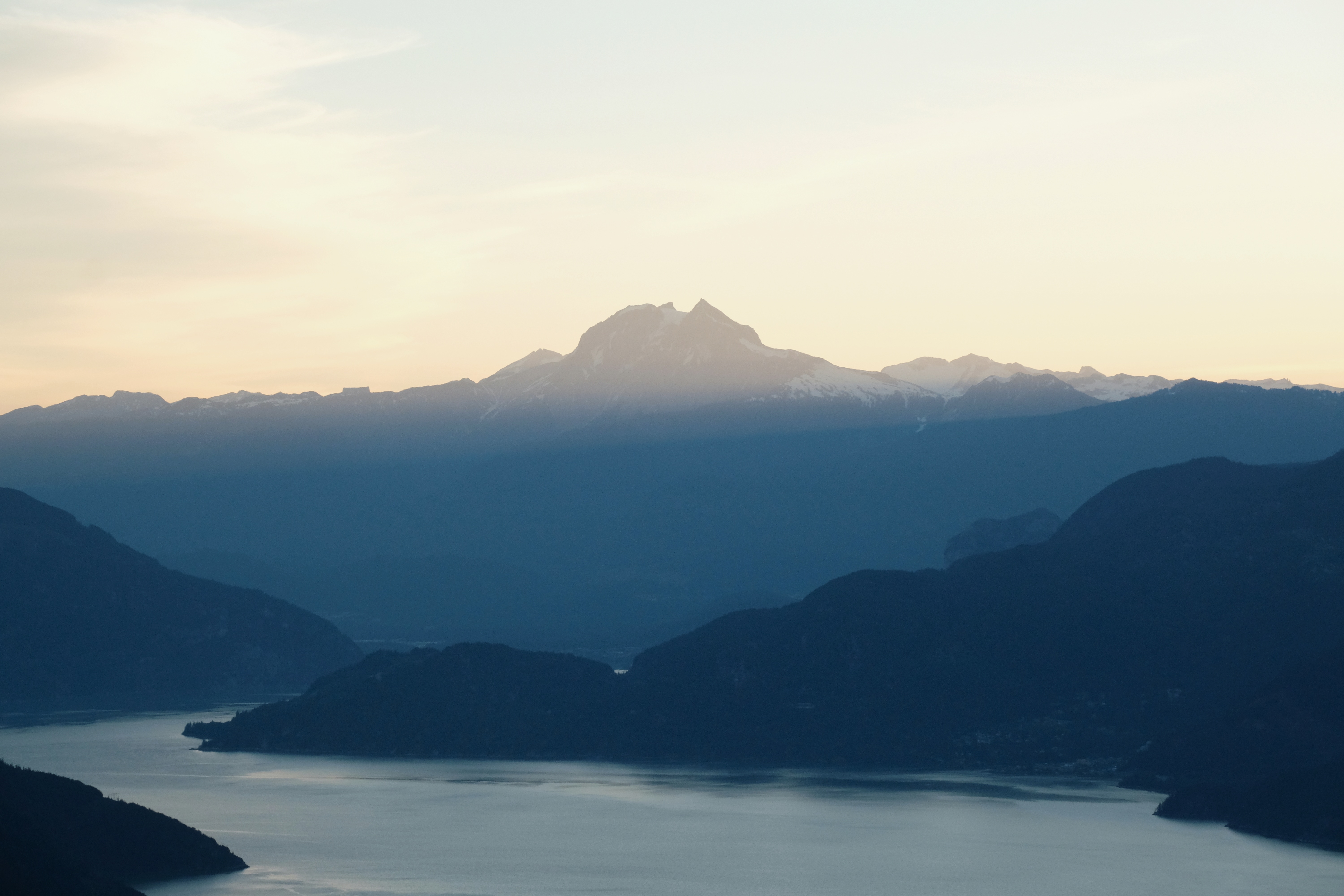
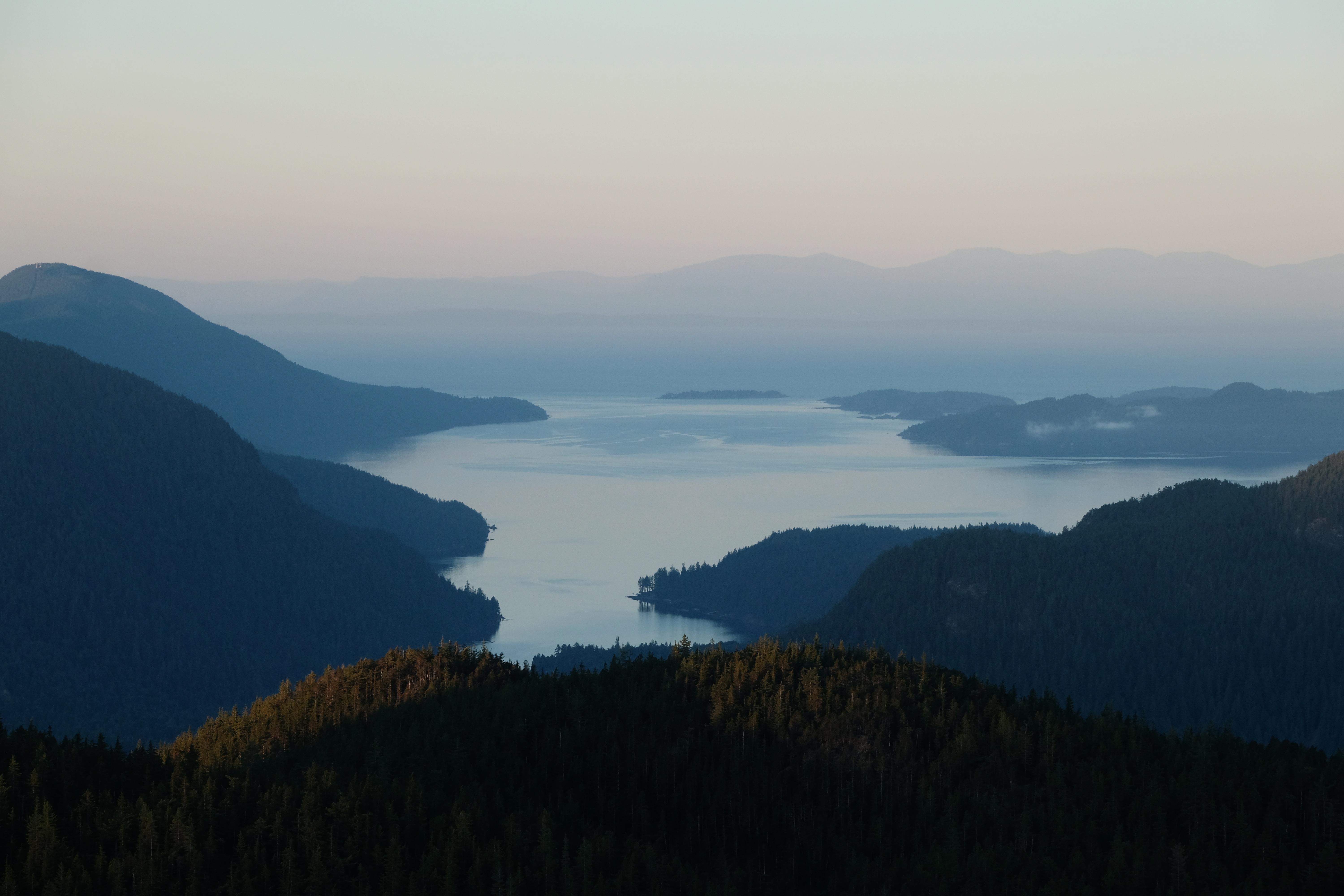
Anvil Island is a scenic island in Howe Sound, between Squamish and Vancouver, BC, recognizable by its pointy peak. This island holds a special place in my heart, and every time I drive back home on the Sea-to-Sky highway, my eyes are drawn to it. Just looking at the peak triggers beautiful memories from my adventures there.
I can’t recommend this kayaking/hiking adventure enough. A paddle along a stunning fjord, wildlife encounters, an enchanted forest and 360° mountain views, it has it all.
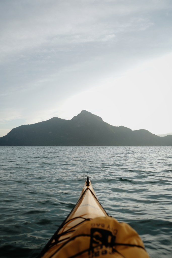
If you asked me to visualize Southwest BC’s typical scenery, I would instinctively picture views from Anvil Island. The different layers of the sea, hilly islands, and mountains are so distinctive of this region that I call them “The layers of British Columbia”.
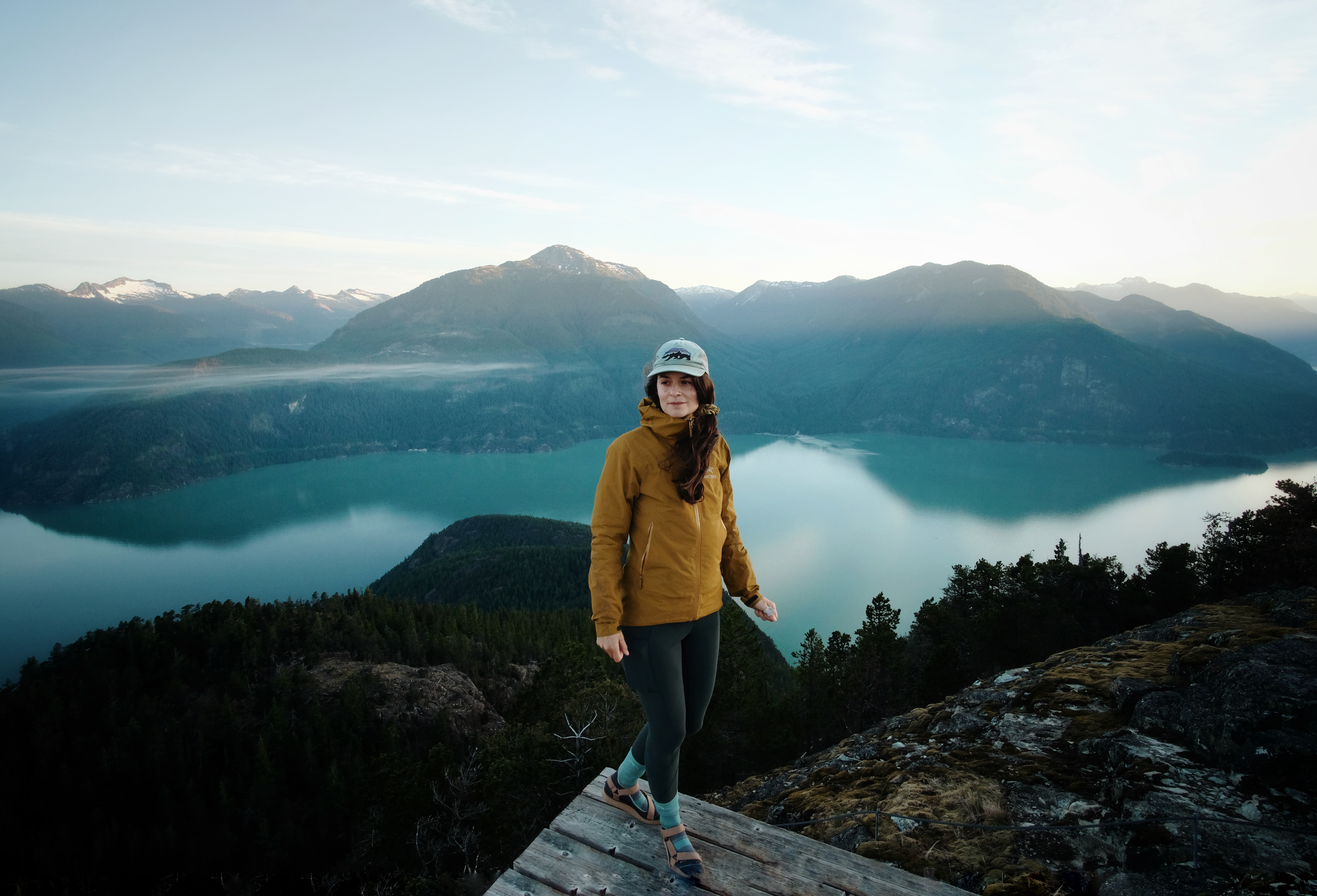
This place is particularly special to me because it’s close to home, but it is still an adventure to get there. When I’m up there at the peak and look down to see where I live, I feel immensely privileged. Firstly, the land I live and recreate on is stunning. Secondly, I have a home where I can sleep in a comfortable bed and still choose to paddle for three hours, hike for three more and risk getting eaten alive by mosquitoes.
This guide will help you prepare for your Anvil Island trip and maybe inspire you to build your own “close-to-home adventure.”
- Anvil Island’s highlights
- Stories from Anvil Island
- Plan your trip
- Kayaking Howe Sound
- Hiking Leading Peak
- Packing tips
Anvil Island’s highlights
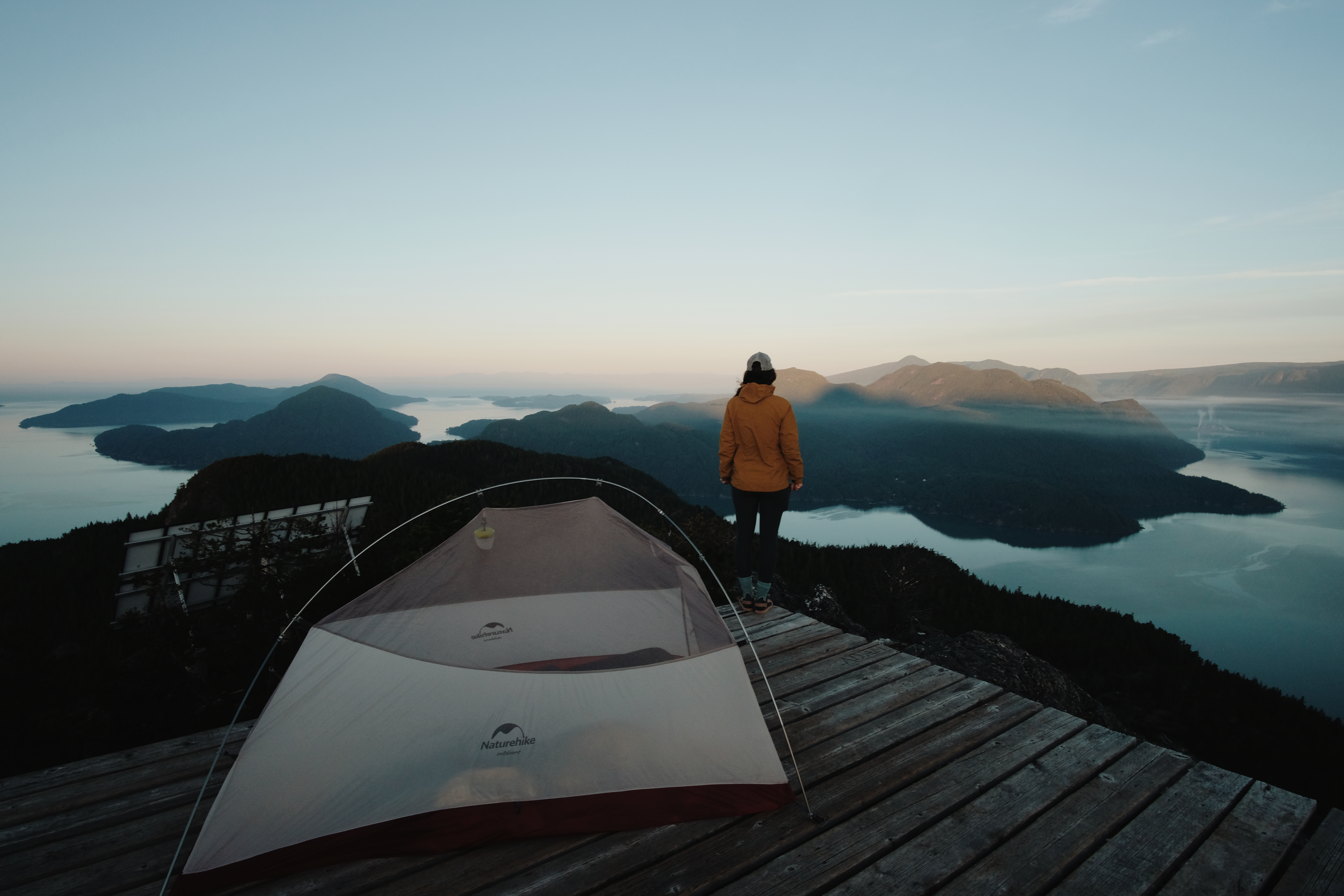
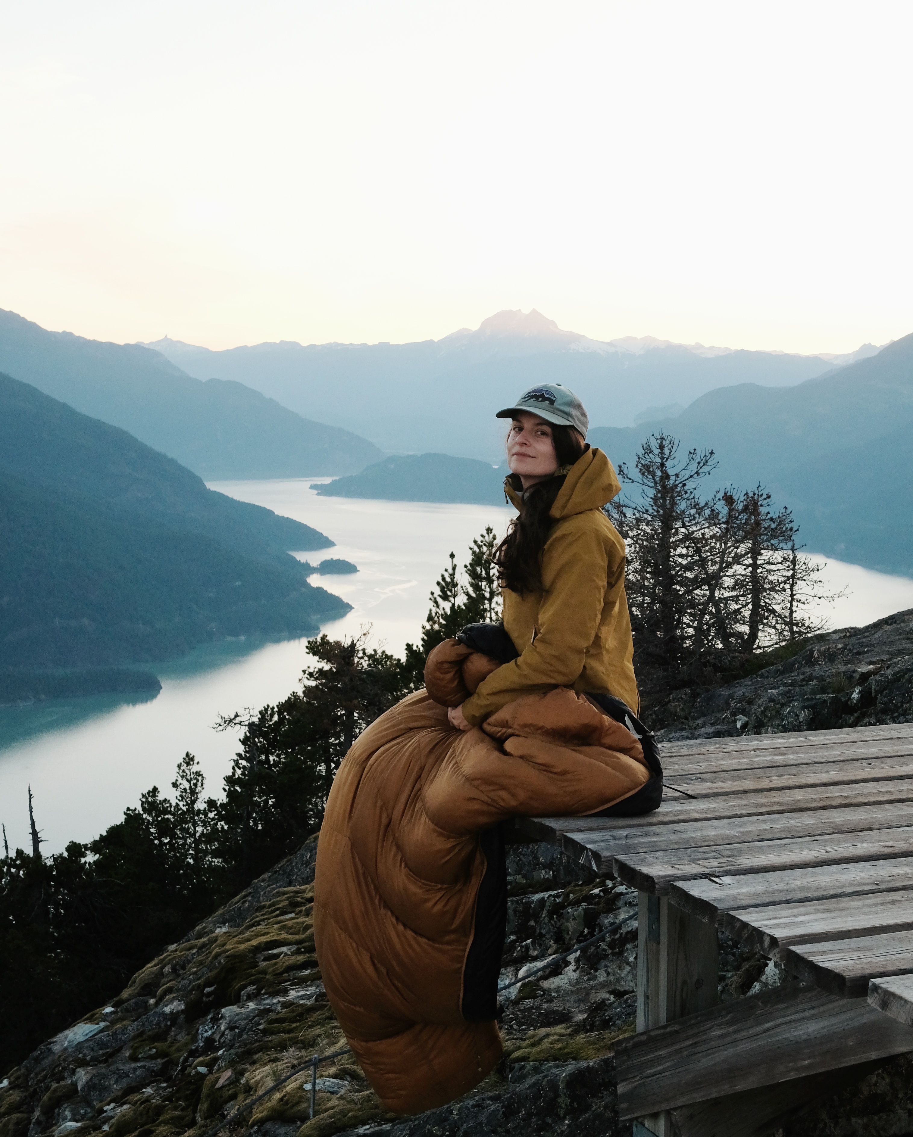
• the 360-degree views from Leading Peak are my favourite in the Sea-to-Sky country. They include Mount Garibaldi, Sky Pilot, Tantalus Range, the Sunshine Coast, and Gambier Island.
• a sense of quietness and remoteness due to the long walk up to access the campsite and the camper quotas.
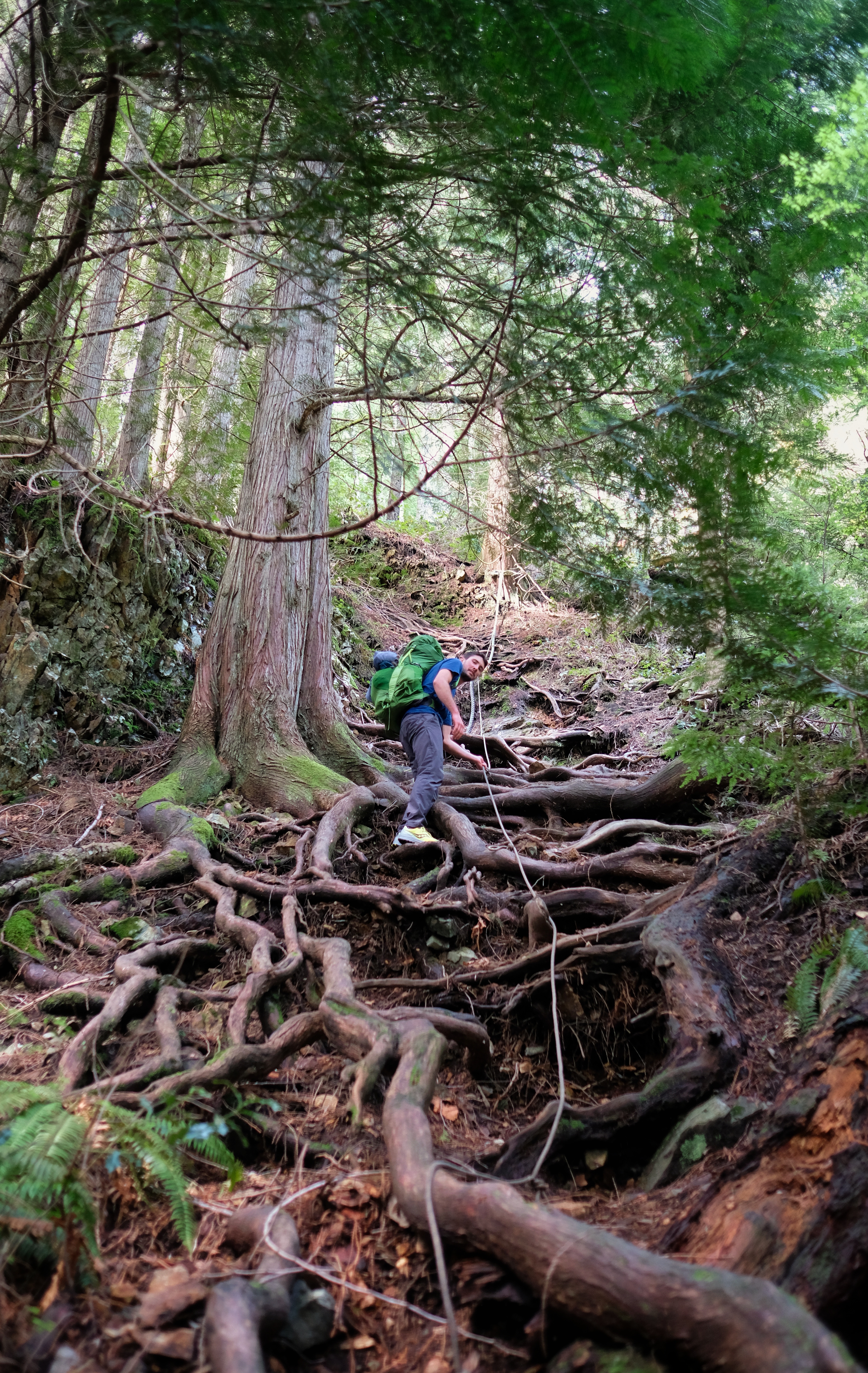
• it can be a nice challenge for newer kayakers. Howe Sound can be windy and wavy, especially in the afternoon. Then, a steep hike with rope sections awaits you. It’s nearly 1000m of elevation gain in less than 5k.
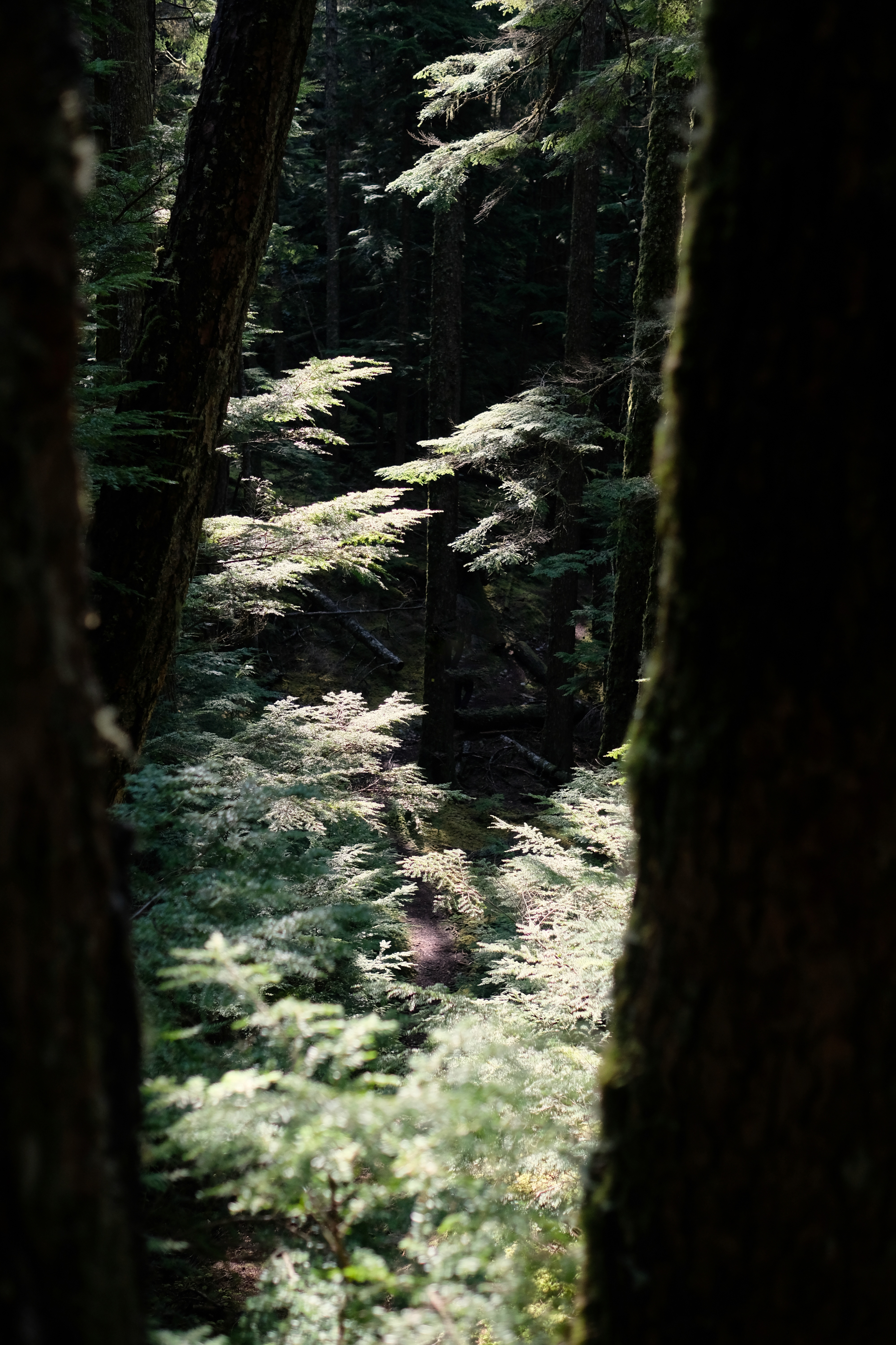
• the preserved old-growth rainforest is truly magical. Make the time to stop and look at the stunning old trees. It’s worth the paddle just to wander in that forest.
Stories from Anvil Island
I camped there for the first time in April 2022, and I will never forget that night. After many times kayaking along Anvil’s shoreline, landing on the beach with my kayak felt like an accomplishment.
Then, it was all steepness and heat. And old trees, ancient trees hovering over us. I brought my friend Henry along, and he had so many tree stories to share.
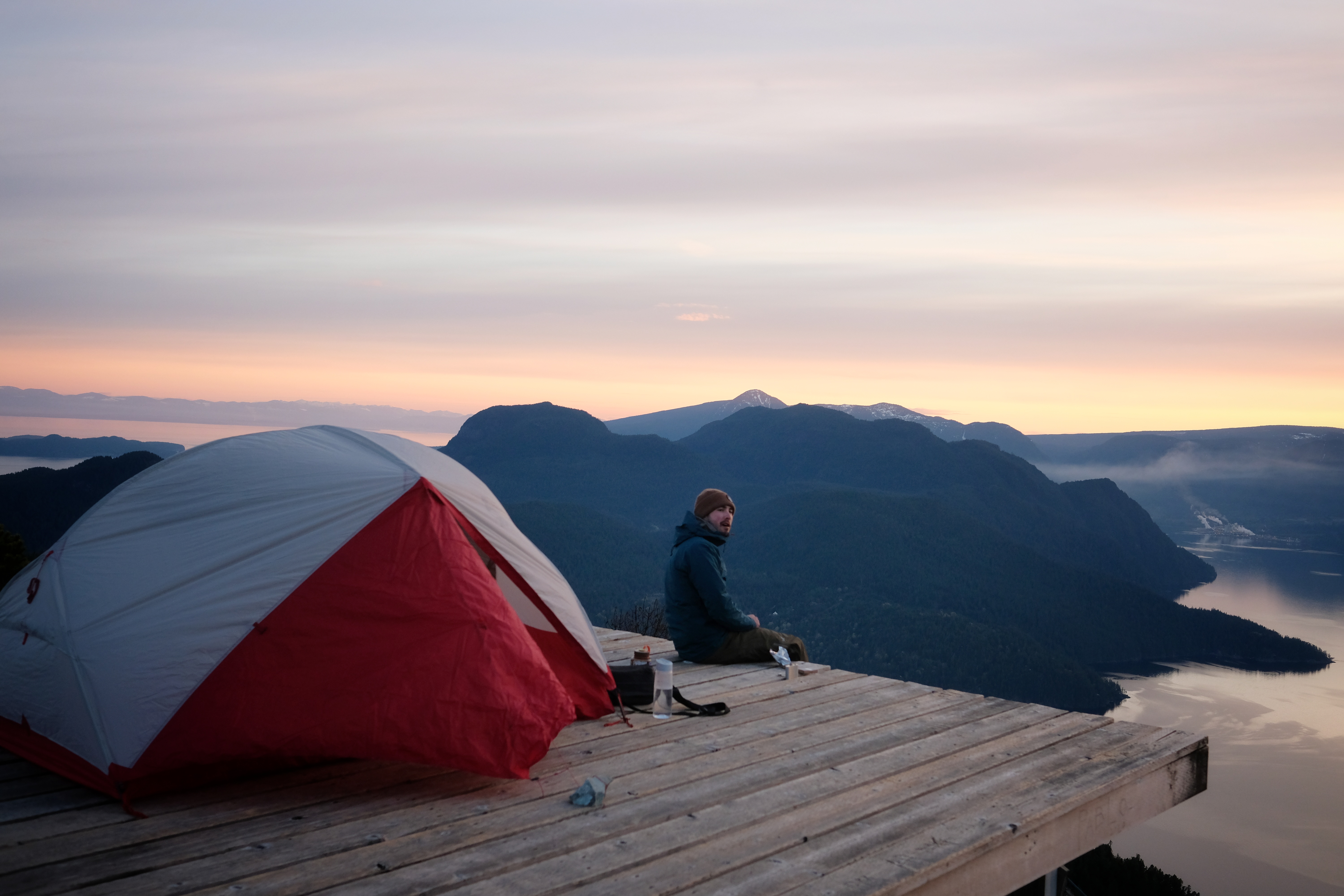
From the night at the top, I remember our astonishment at the dreamy scenery and the smell of whisky and spicy chocolate we prepared to warm us up.
We watched the sun set behind light clouds and glowing peaks, and the mountains and surrounding islands looked gorgeous at the blue hour.
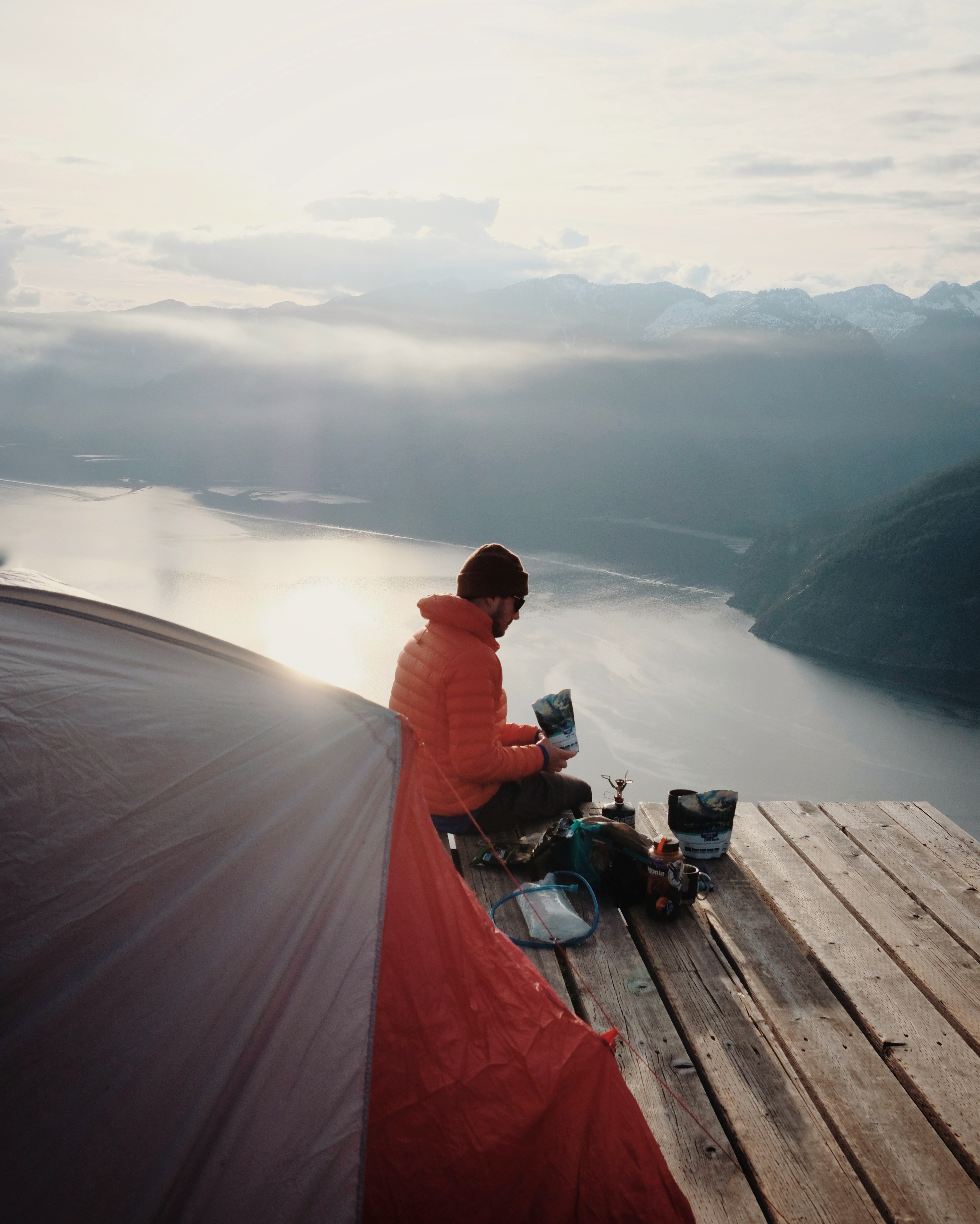
I remember the wind blowing all night and keeping me half-awake. And the peaceful morning watching the sunrise and drinking black tea.
It was a mix of different things that made this adventure so special:
- Good company: as a memorable camping night often involves long talks with a good frien
- Breathtaking views: the initial reason we embarked on this journey.
- A sense of accomplishment: that feeling of satisfaction when realizing that your body got you through a fjord and up that damn steep rock on an after-work “little stroll.”
Plan your trip
When to go?
Daybreak Point Bible Camp only allows access to the island during the Spring and Fall, as they run camps in July and August. I prefer April and May when the days get longer. Also, Anvil Island is a good Spring hike option compared to the slippery slushy snow of the Sea to Sky mountains.
To fully enjoy the experience, go in the low season and avoid weekends if possible. I only camped at Leading Peak twice (though I paddled to Anvil many times), and we were always the only people there. Now, I know not everyone is lucky enough to go camping mid-week, but for those who can (hey, fellow freelancers!), please do.
The island has become increasingly popular over the years, yet it is rarely crowded because of the registration system. When adventuring there, practice the Leave No Trace Principles. If you see trash left at the campsite by previous hikers, be cool and bring it down.
How to get to Anvil?
You can take a water taxi to Anvil Island from Horseshoe Bay (accessible via bus from Vancouver). The last time I checked, it cost about $200 for a maximum of 6 people. The Squamish local business Sea Dog Expeditions offers trips to Anvil Island.
Or you can choose the more adventurous option: kayaking there (see below).
Registration
Before you go, you must book your spot by emailing Shannon at admin@anvilisland.ca. Registration is free with an optional donation to Daybreak Point Bible Camp.
You communicate your preferred date, preferred arrival window (9-10 am or 3-4 pm), the number of people and the time you plan to leave the next day. You must also sign a waiver and hand it over when you arrive. The only way to access Anvil Island is through the Camp, the other beaches are private property.
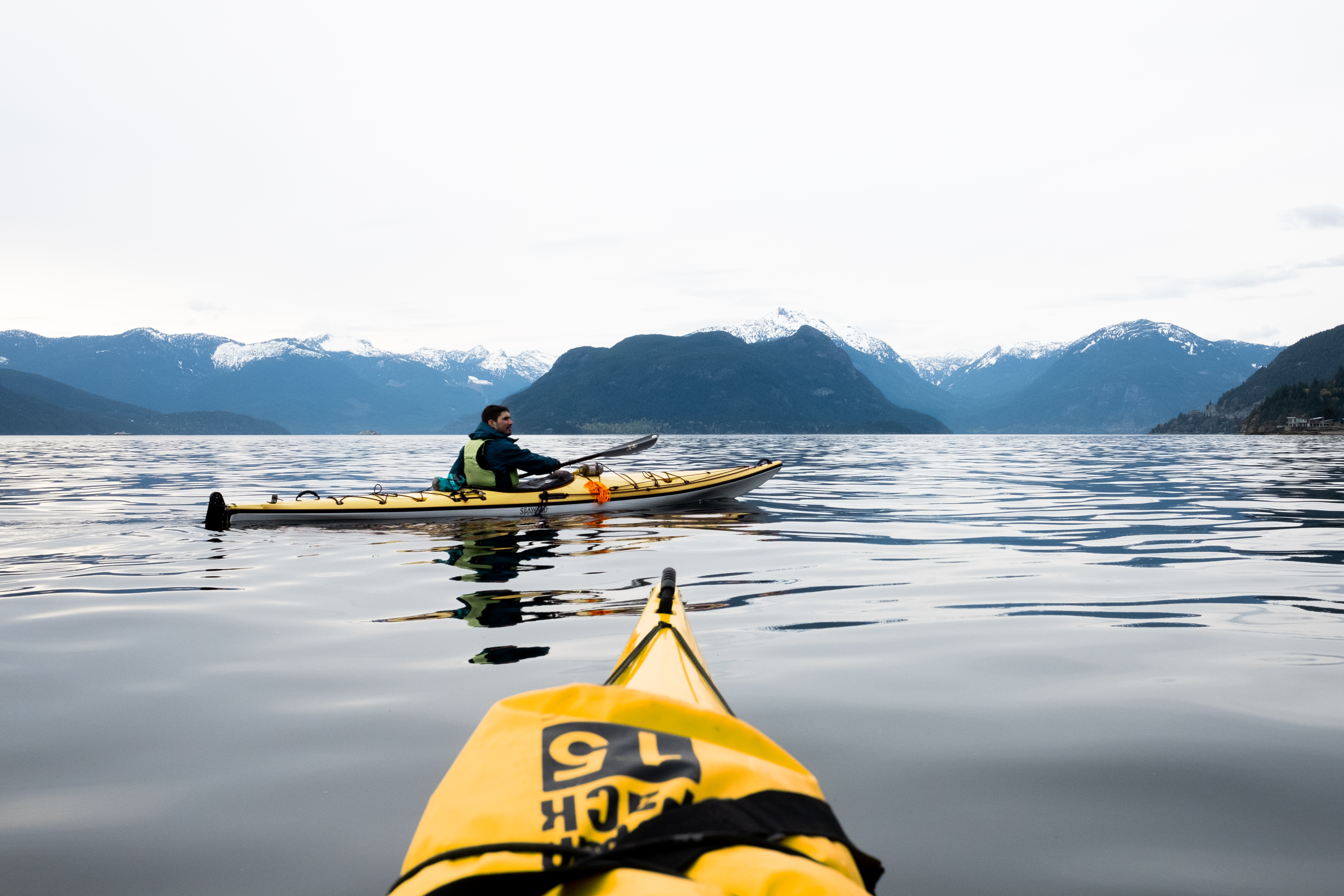
Kayaking Howe Sound
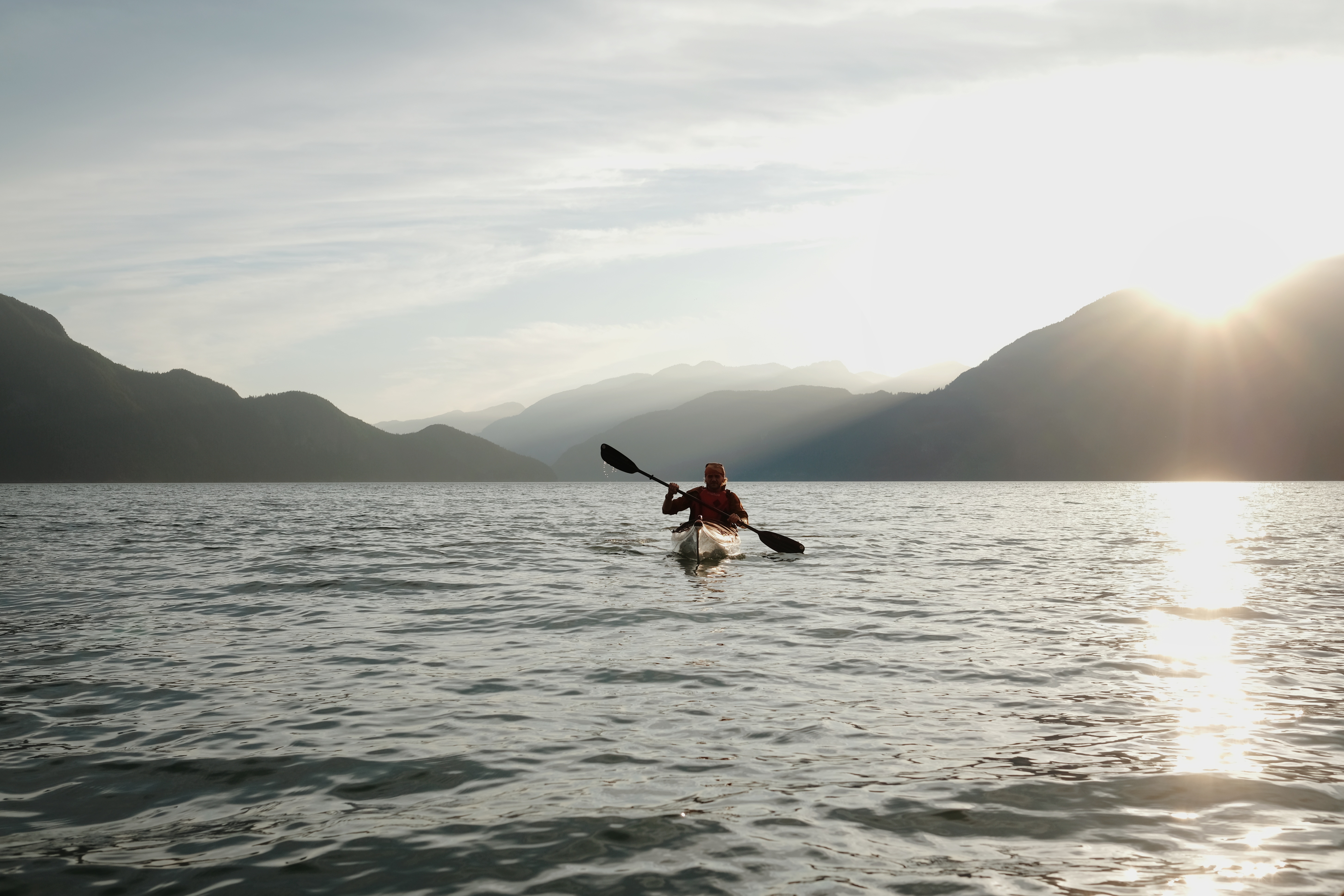
if you chose to kayak, you picked the most rewarding journey to Anvil Island, which is also ocean-friendly. Boat traffic in Howe Sound is high and impacts wildlife, so if given the choice, I prefer to avoid motorboats for recreational purposes.
Safety Basics
Howe Sound is well-known for its wind. In the summer, the southbound wind blows in the afternoon, so many kayakers prefer to go out in the morning and avoid being on the water after the wind picks up.
I’ve been in Howe Sound from February to November and rarely saw calm waters throughout the day. Always check the weather forecast before you go.
There are many apps that allow you to check wind forecasts. My favourites are Ventusky and Windy.com. I always cross-check with the marine forecast issued by the government at weather.gc.ca. I usually look at the forecast when planning a kayak trip, the night before, and again when launching. Then, I assess every two to four hours depending on the area, the trip length, and the conditions.

A complete guide to kayaking Desolation Sound
Where to camp, itinerary ideas, what to pack and safety basics.
Prepare for your upcoming kayaking adventure.
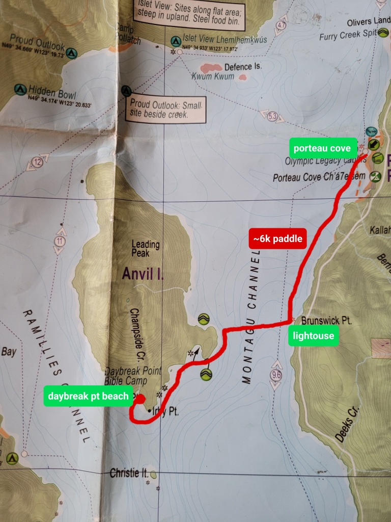
Paddling route
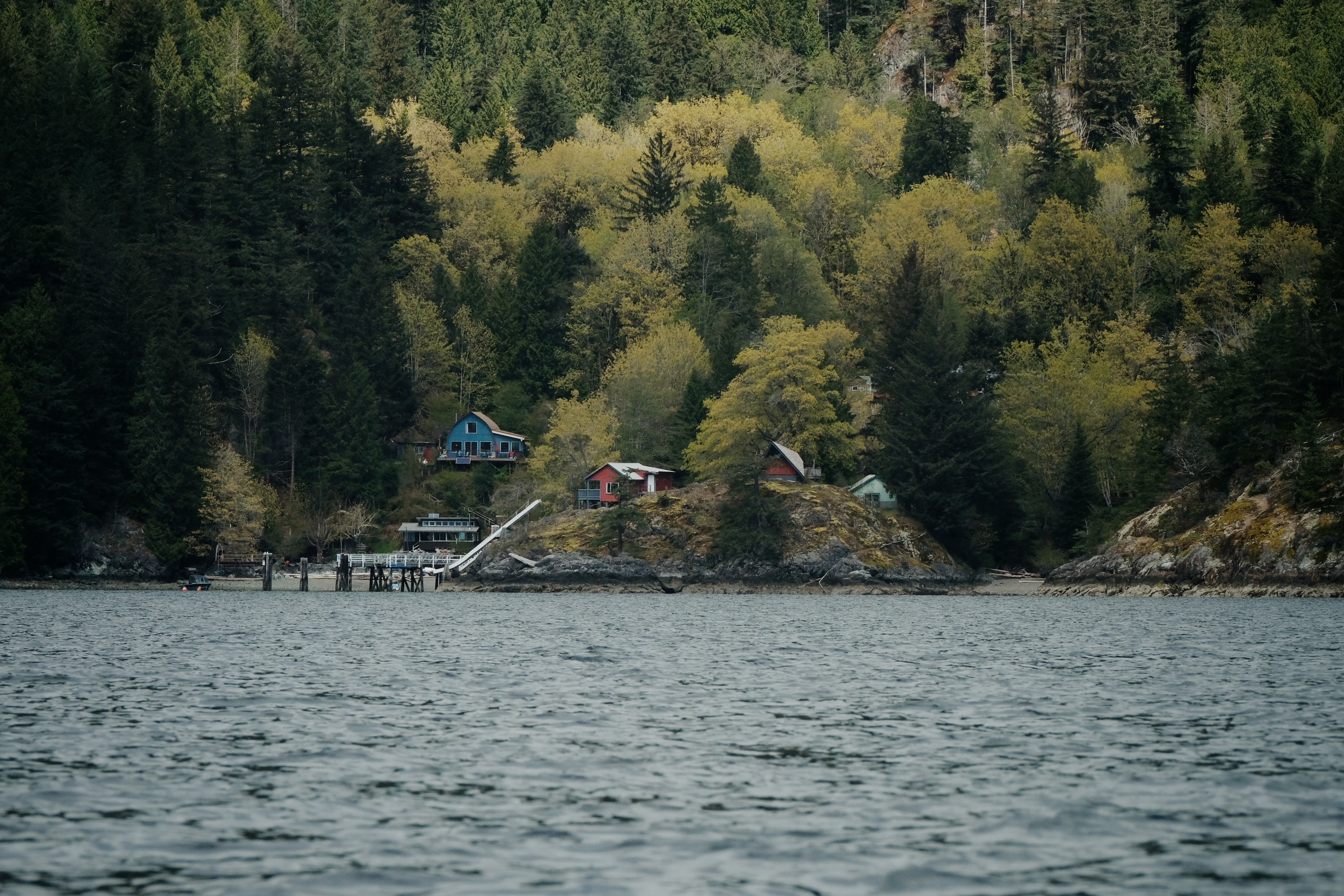
Porteau Cove is the closest launch to Anvil. It’s about 6 km from there to Daybreak Point, the only kayak access to Anvil Island. Whatch out! The parking lot gets crowded on weekends, so plan to arrive early. At the Porteau Cove campground’s gatehouse, you can get an overnight parking permit for $12. Other launch options are Britannia Beach, further north, and Lions Bay, further south.
From Porteau Cove’s boat launch, paddle 4 km south until you reach the lighthouse of Brunswick Point. It’s the shortest crossing to reach the East side of Anvil Island. After you cross Howe Sound and reach the shoreline of Anvil, keep going south until you reach the southern tip of the island (Irby Point). Around the corner is Daybreak Point.
I’m not a fast paddler, as I often stop to take pictures and observe wildlife, but most paddlers can make it in two hours. I would suggest taking a three-hour window because the conditions can get rough, and you never know; you might encounter orcas on the way and stop to watch them pass by.
Once you arrive at Daybreak Point Beach, you can park your kayaks up the beach and attach them to the heavy driftwood.
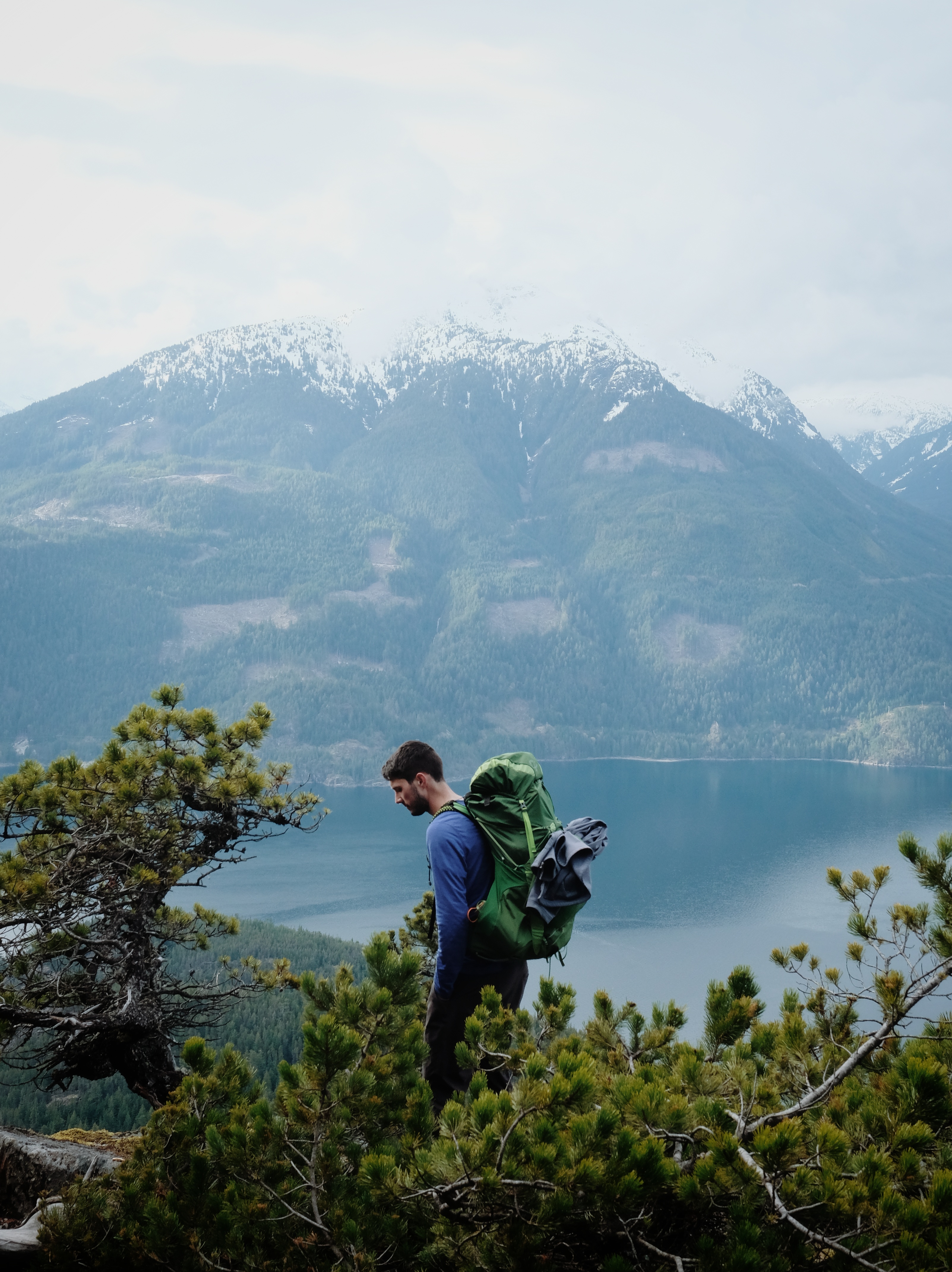
Hiking Leading Peak
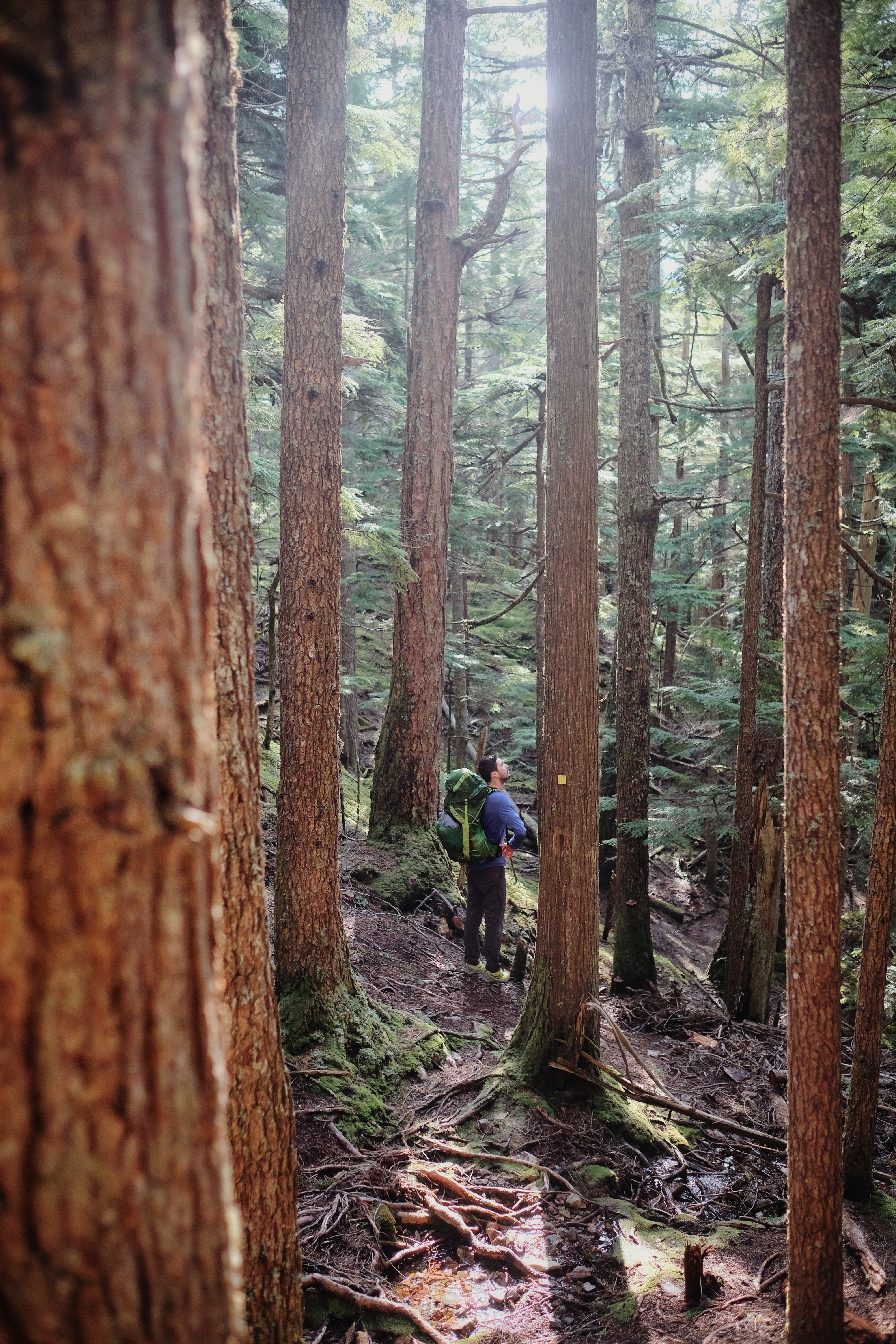
The hike to Leading Peak is relatively short (about 5 km each way) but steep. It usually takes me between 3 and 4 hours to reach the top, with an overnight pack and many stops for photos. Some ropes help in the most challenging sections, but the trail is never exposed. The trail is well-marked, and there is no route-finding involved.
I suggest stopping at White Spot Viewpoint for a snack break. Somewhere near 1 km point, you’ll reach an intersection with a sign indicating the viewpoint on the right. The ascent is relentless until you reach Chamspide Lake. Then, it goes slightly downhill until the final climb to Leading Peak. There are a few scrambling sections at the end, but nothing too scary or challenging.
You can find water in a stream at the beginning of the hike, and at the lake further up. Bring plenty of water with you. I was always running hot when hiking this trail.
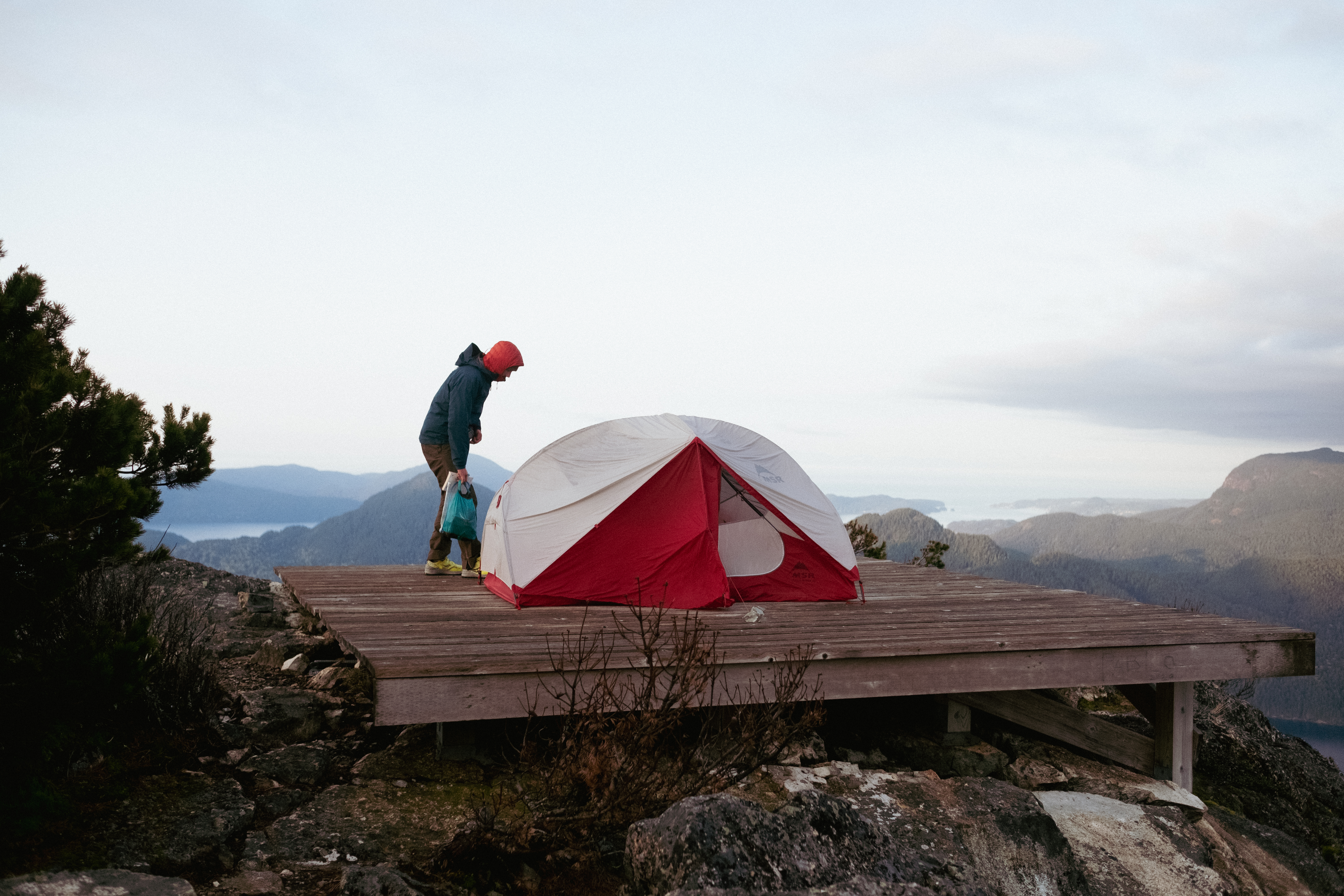
Once at the top, enjoy the view! Or run to grab a spot on the helipad, set up your tent and enjoy the view afterward. It can get pretty windy at night, so pack good windbreakers and warm layers.
Packing tips
Packing will be a little more challenging for those who kayak to get to the trailhead, as you’ll have to carry your hiking gear on the water. I have a roomy kayak, so I can fit my backpack into one of the hatches. Another option is to wrap your backpack in a waterproof sealed bag and strap it onto your kayak deck. It’s not the best, but for a two-hour paddle, it will do.
When starting the hike, I leave all my paddling gear in the cockpit and the hulls, along with extra water for the paddle back.
As for the overnight hike itself, I suggest that you pack light for two reasons. First, it’s steep, so a heavy backpack can slow you down and prevent you from grabbing the Graal (or helipad). Second, if you do this hike in Spring and are not a winter camper, carrying a lot of weight over 10 km might be challenging in the early season.
If you’re planning this paddle/hike and have questions, please let me know in the comments!

Our secret spot is out ! 😱
LikeLike
Haha it’s been a while it’s not a secret spot anymore. it’s time for others to enjoy it as well 🙂
LikeLike